
 Image 1 of 4
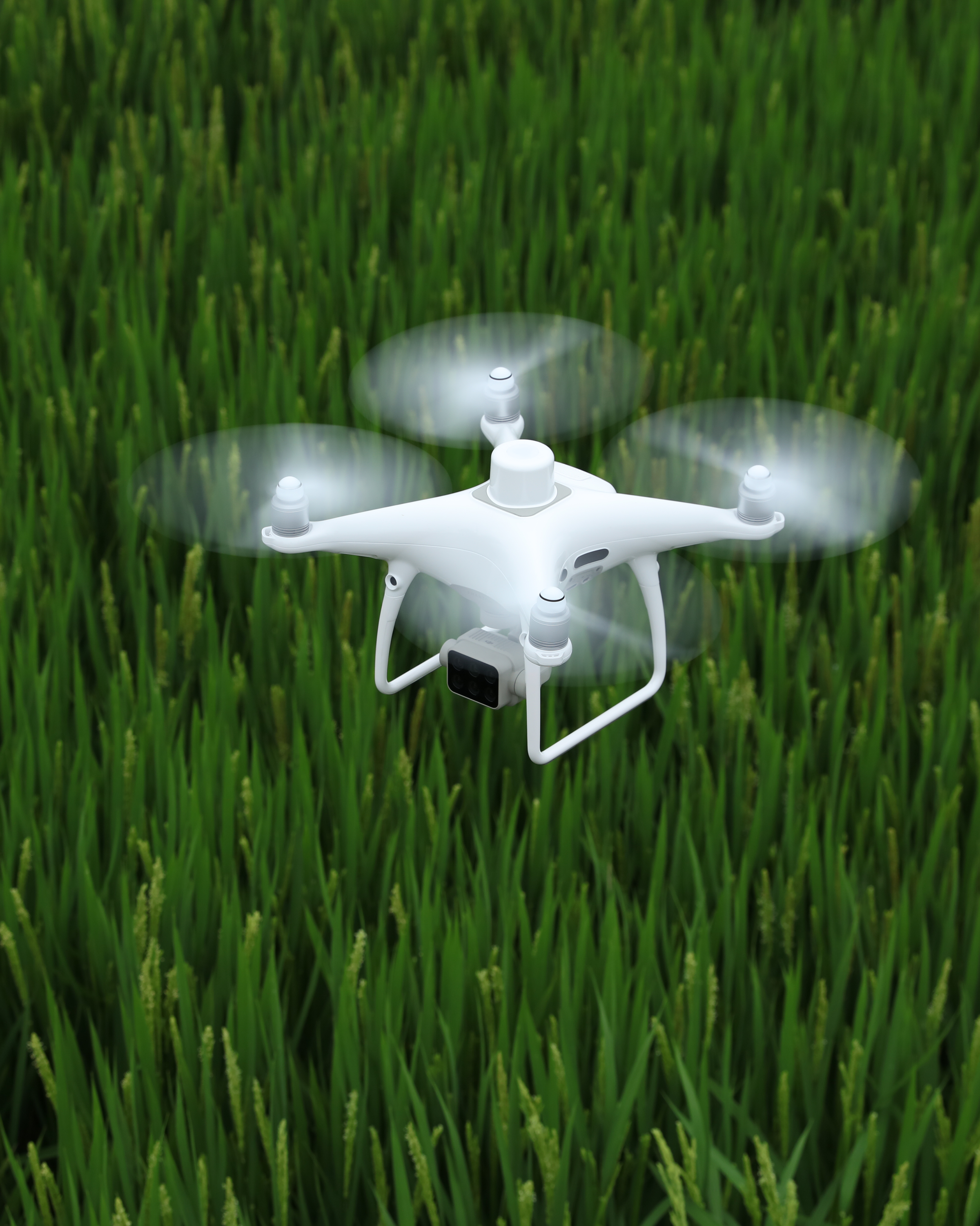 Image 2 of 4
 Image 3 of 4
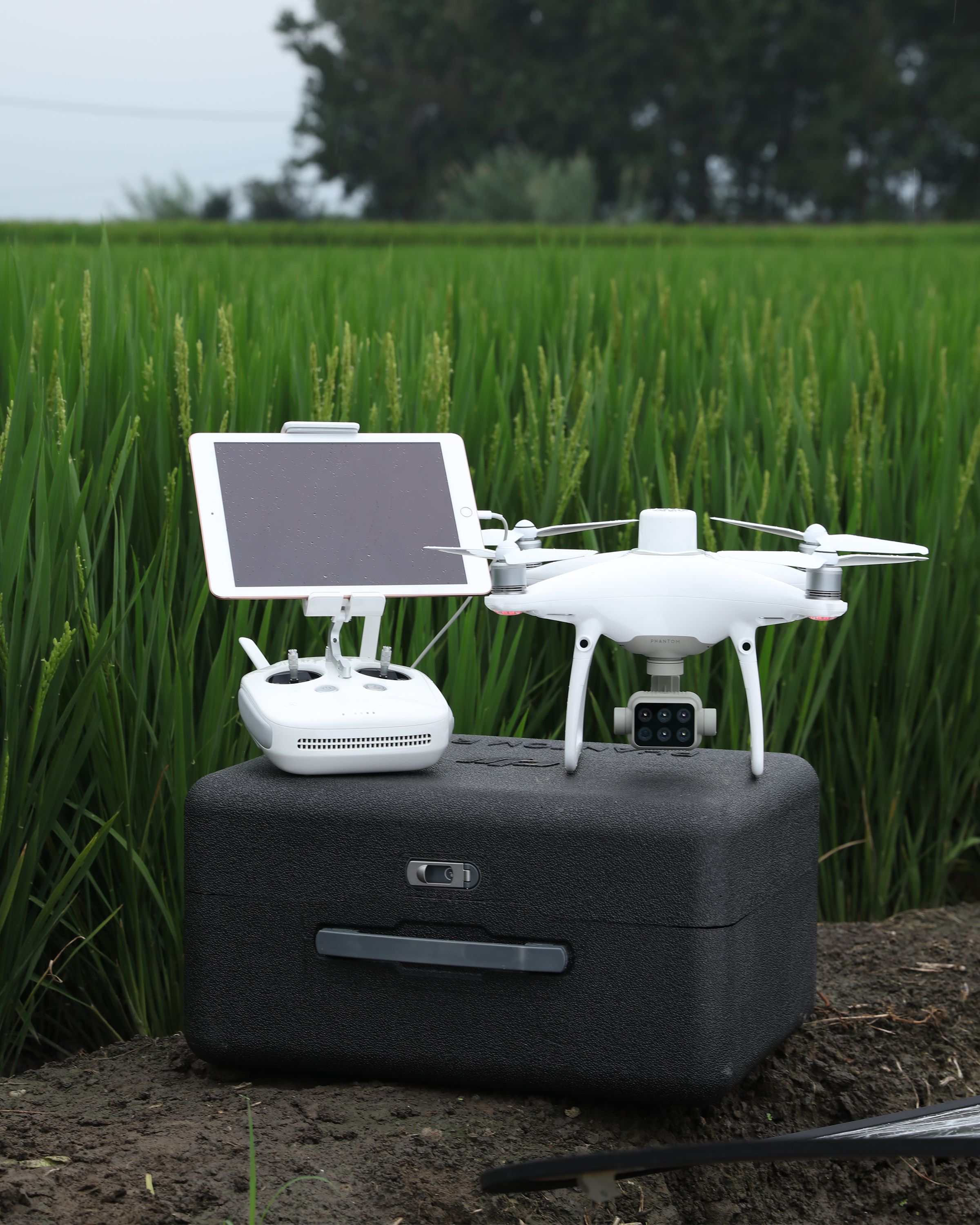 Image 4 of 4
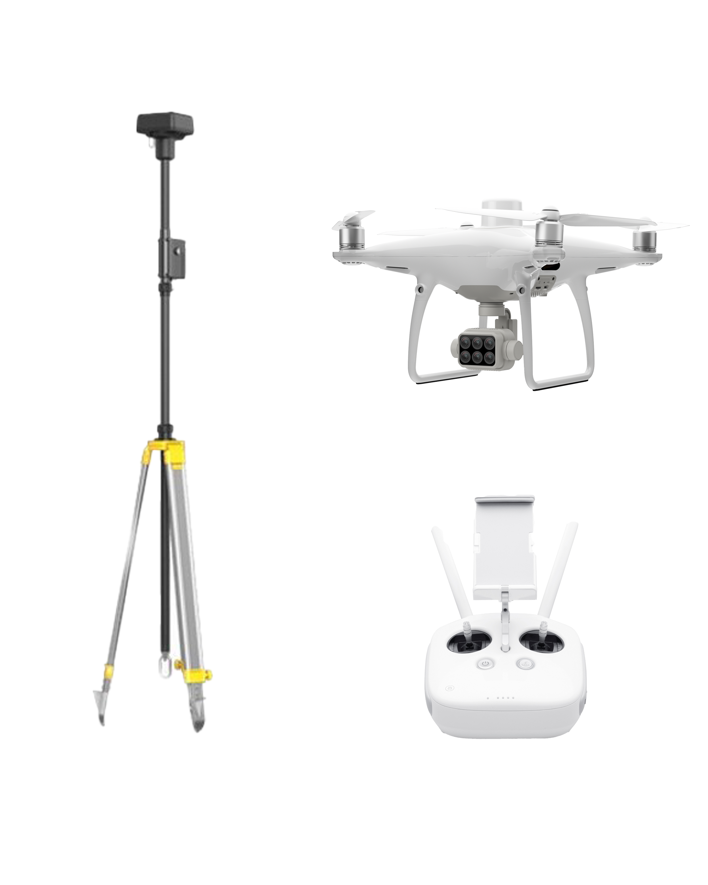
DJI Phantom 4 Multispectral RTK + D-RTK 2 Mobile Base Station
Gather precise plant-level data using the P4 Multispectral – a high-precision drone with a seamlessly integrated multispectral imaging system built for agriculture missions, environmental monitoring, and more.
Included in the package:
1x DJI Phantom 4 Multispectral RTK Drone
1x Remote Controller
2x Intelligent Flight Battery
4x Propeller Pair
1x AC Power Adapter
1x Intelligent Battery Charging Hub
1x AC Power Cable
1x SD Card
1x OEM Carrying Case
1-Year DJI Terra Basic Software
DJI Enterprise Shield Basic
1x DJI D-RTK Mobile Base Station
(Tripod can be added)
Gain Immediate Insights into Plant Health
The P4 Multispectral consolidates the process of capturing data that gives insight into crop health and vegetation management. DJI has created this platform with the same powerful performance standards that DJI is known for, including 27 minutes max flight time and up to 7 km transmission range with the OcuSync system.
See Beneath the Surface
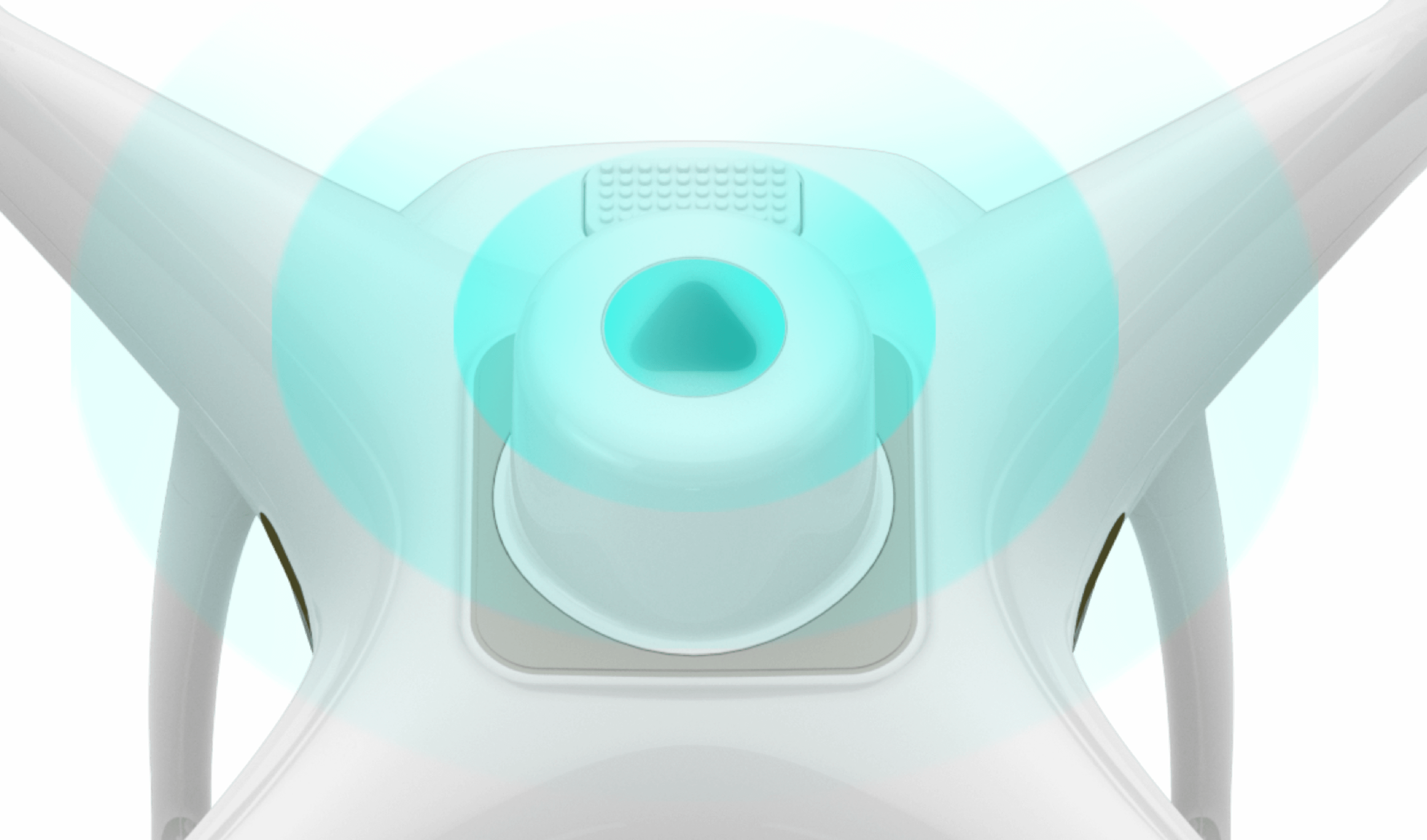
Agriculture imagery collection is now simpler and more efficient than ever before with a built-in stabilized imaging system that collects comprehensive data sets right out of the box. Access information collected by 1 RGB camera and a multispectral camera array with 5 cameras covering Blue, Green, Red, Red Edge, and Near Infrared bands – all at 2 MP with global shutter, on a 3-axis stabilized gimbal.

Integrated Spectral Sunlight Sensor for Accurate Results
An integrated spectral sunlight sensor on top of the drone captures solar irradiance, which maximizes accuracy and consistency of data collection through different times of day. When combined with post-processed data, this information helps to obtain the most accurate NDVI results.
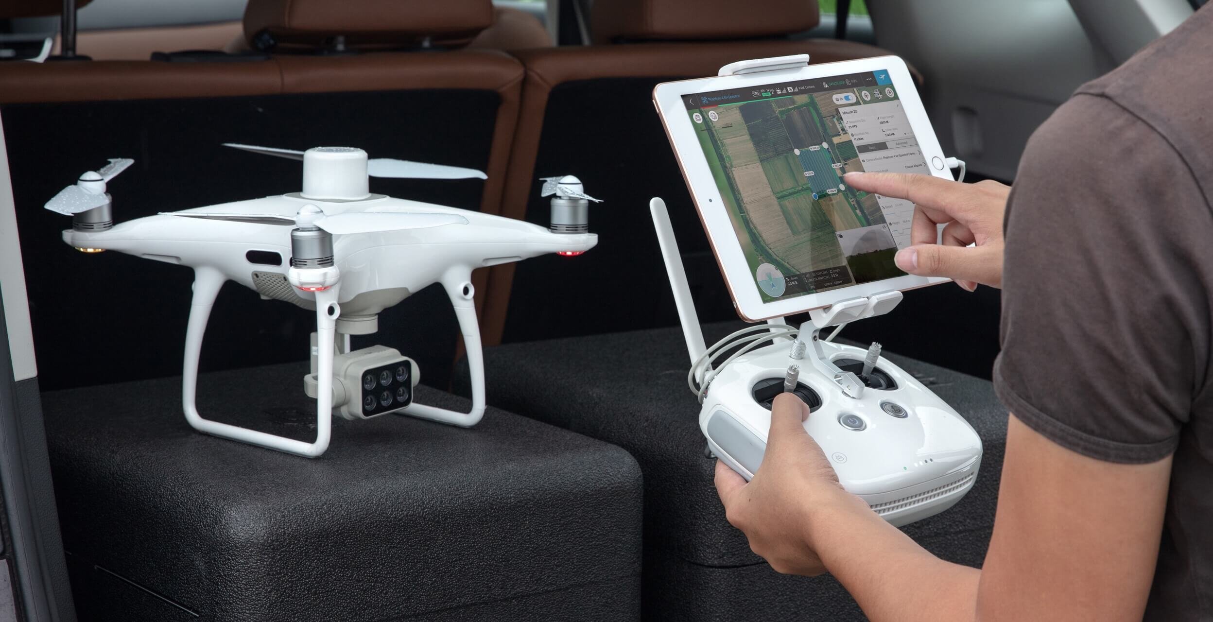
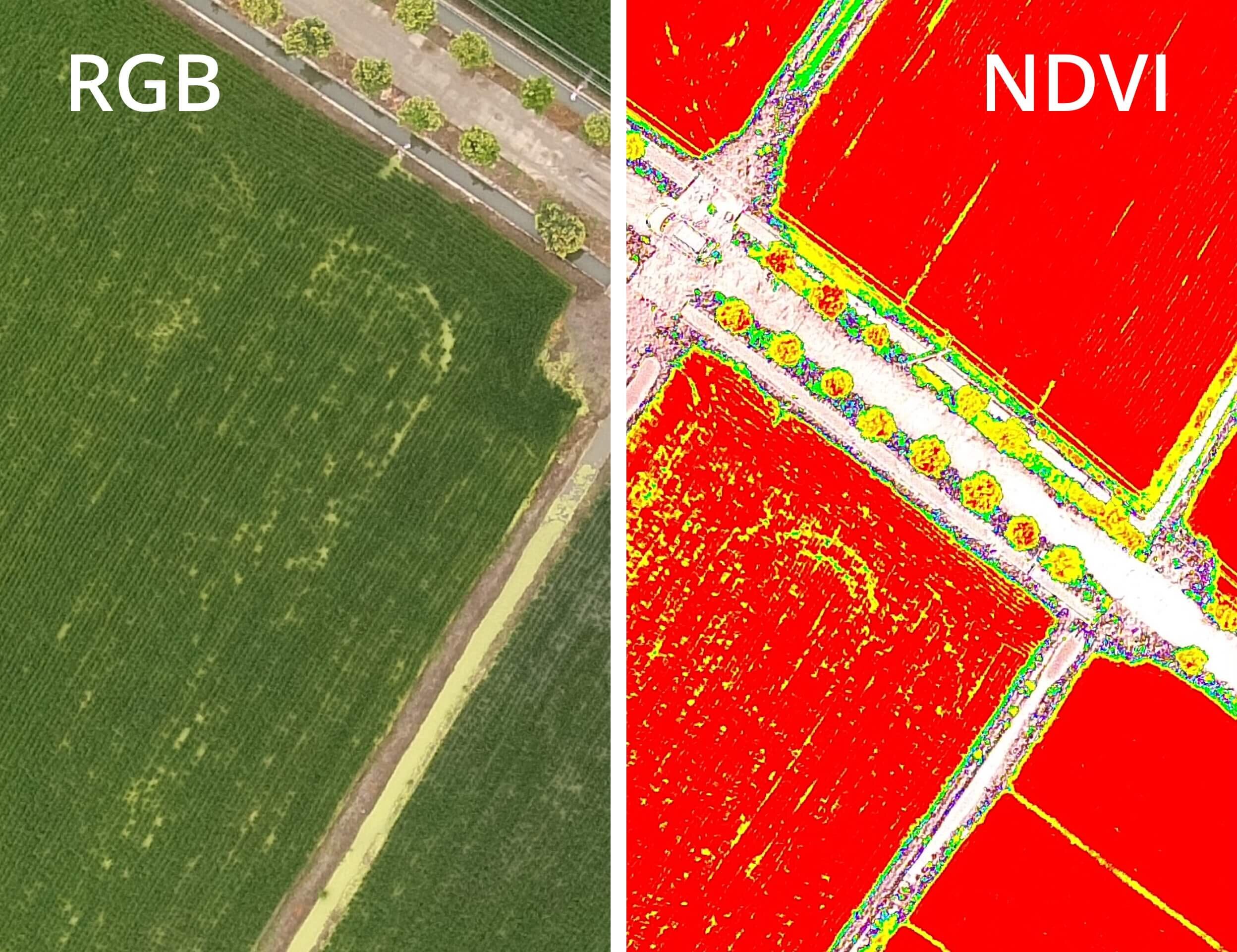
View Both RGB and NDVI Feeds
Simply having aerial imagery is not enough for ag professionals who want to know more. Switch between a preliminary Normalized Difference Vegetation Index (NDVI) analysis and the live RGB feed to immediately visualize where attention is needed, so targeted treatment decisions can be made quickly
Centimeter-level Precision
Get real-time, accurate positioning data on images captured by all six cameras with DJI’s TimeSync system, providing centimeter-level accurate measurements. The TimeSync system continually aligns the flight controller, RGB and NB cameras, and RTK module, fixing the positioning data to the center of the CMOS and ensuring each photo uses the most accurate metadata. All cameras go through a rigorous calibration process where radial and tangential lens distortions are measured. The distortion parameters gathered are saved into each image’s metadata, letting post-processing software adjust uniquely for every user.

D-RTK 2 Mobile Station and NTRIP Compatibility
Enhance the accuracy of RTK positioning without internet connection by connecting the P4 Multispectral to the D-RTK 2 High Precision GNSS Mobile Station and NTRIP (Network Transport of RTCM via Internet Protocol), or store the satellite observation data to be used for Post Processed Kinematics (PPK).
