
 Image 1 of 5
 Image 2 of 5
 Image 3 of 5
 Image 4 of 5
 Image 5 of 5
WingtraOne GEN II
WingtraOne GEN II, the next level of drone worksite reliability and mapping versatility with an oblique payload leading the way.
NDAA Compliant
Maximum Flight Time of up to 59 min
Multiple Payload Options
Weather Resistance: IP54
Wind Resistance: Max sustained wind: 12 m/s (27 mph), Max wind gusts: 18 m/s (40 mph), Max sustained wind on the ground: 8/ms (19 mph)
Max. Take-off Altitude Above Sea Level: 2500 m (8200 ft), with high-altitude propellers, can take off up to 4800 m (15,700 ft) and fly up to 5000 m (16,400 ft) AMSL
Flight Speed: 16 m/s (35.8 mph)
Auto-Landing Accuracy: < 2 m
Get a Quote
Applications

Photogrammetry


LiDAR

Get your survey data faster
The WingtraOne mapping drone’s unique set of features empowers you to minimize your time flying and get more work done, be it another project in the field or analyzing your data at the office.
Efficient fixed-wing flight
Fly at 16 m/s (36 mph) for up to 59 minutes per flight for large coverage.
No more GCPs, checkpoints only
With an onboard high-precision PPK GNSS receiver you no longer need to lay out ground control points (GCPs). Use as few as three checkpoints to verify your map quality.
Lower image overlaps
High quality optics means you can reconstruct your map reliably even with lower overlaps. This means more new ground covered per flight line and maximum coverage per flight.

Multiple Payload Options

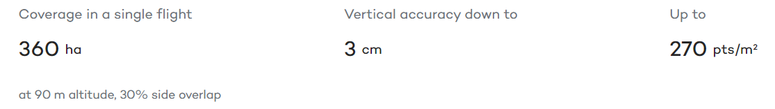
RGB61
Powered by the Sony Alpha A7R Mark IV, RGB61 guarantees maximum coverage, superior accuracy and a lighter data load, while offering in-app light settings control.
Sony RX1R II
Ultra-high resolution 42 MP camera with full-frame sensor and low distortion lens. Together with PPK, this camera delivers absolute accuracy down to 1 cm (0.4 in).
Sony a6100
The a6100 camera from Sony offers the best combination of accuracy and coverage for an affordable price.
Oblique Sony a6100
Optimised to map vertical structures, the Oblique Sony a6100 allows you to generate high-resolution 3D meshes with centimeter level absolute accuracy.
MicaSense RedEdge-P
Premium multispectral camera, which combines a panchromatic sensor with five narrow bands to produce high-resolution multispectral and RGB from one flight
Wingtra LIDAR
WingtraOne and its LIDAR sensor combine efficiency, ease of use, and reliability to create exceptional digital terrain models, revealing terrain beneath dense vegetation.
Technical Specifications WingtraOne GEN II
